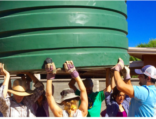
What do you know about your own watershed?
Do you know the name of the closest creek to you, whether above ground (daylighted) or running through an piped infrastructure system? Too often, we are unnaturally disconnected not only from our water sourece. OK, that’s a bit understandable, as in California, water can travel up to 1800 miles to reach your tap, such as is the case with San Diego’s Colorado River supply. But every one of us is living in a watershed and working in a watershed, perhaps not even the same one. Basically, wherever you are on land, you are standing in a watershed. And what happens in your watershed impacts the local groundwater, the local surface (piped and piped) and ultimately both water supplies and water quality. Take a look at this watershed diagram to see where you might be in your watersehd as you read this post – Where the precipitation falls? Nearby a stream that feeds a more central river? By the shoreline where some stormwater may be passing into the ocean? In the middle of an urban block underwhich a stream is passing by inside of an infrastructure pipe?

If you don’t know what watershed you live or work in, there are a number of ways to figure out that out. One is by visiting the US EPA’s watersehd mapping tool that will locate you in your watershed. Another way is to locate a watersehd group working in your county that can help you determine your own watershed. They will likely have information and activities related to your watersehd and what is being done to maintain and improve it’s condition. Also, it’s worth checking out The Water Education Foundation’s full-color slideshow detailing California’s watersheds.
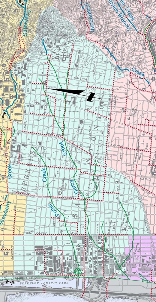
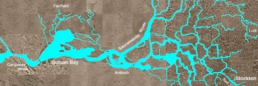
Those living in San Francisco or the East Bay of the Bay Area are fortunate to have excellent watersehd maps provided through the Oakland museum. Through these maps I learned that I live smack over Derby Creek in Oakland. While the map shows me that Derby Creek is piped in my area, some of Derby Creek still seeps through the ground. Hence the small curly willow cutting from a flower bouquet that I planted 5 years ago turning into a 35 foot tree without any regular watering! My location in my watersehd impacts what I can grow and how much I have to water what I can grow, both important bits of information for a water conservation maniac such as myself.
The State Water Resources Control Board has launched a survey about your knowledge of your watershed that is part of the release of their new phone app for learning more about your own watershed. It also allows you to particpate in information documentation about your wastershed.
Creekwatch wants to hear from you! By completing this survey you are supporting research on water management and conservation programs – thanks for taking 5 minutes to answer some questions. At the end of the survey, you’ll be asked to enter a drawing for $10 Amazon.com gift certificates, as a thank you for your time.
Help the environment by participating in this water conservation research survey and earn the chance to win $10 at Amazon.com
The Creek Watch App uses four pieces of data:
- The amount of water: empty, some, or full.
- The rate of flow: still, moving slowly, or moving fast.
- The amount of trash: none, some (a few pieces), or a lot (10 or more pieces).
- A picture of the waterway.
This data helps watershed groups, agencies and scientists track pollution, manage water resources, and plan environmental programs.
Creek Watch is a project developed at IBM Research – Almaden in consultation with the California State Water Resources Control Board’s Clean Water Team.
Get to know your watershed!
