Strawberry Creek
Strawberry Creek is a major landscape feature of the University of California, Berkeley, and a primary reason the site was chosen in the 1860s as the location for the campus. More than 3,000 university students, and many elementary and high school students from surrounding communities, use Strawberry Creek each year as a resource for education and research.
Enjoy a Virtual Tour Strawberry Creek
Welcome to your great opportunity to learn the human and natural history of the Strawberry Creek Watershed. The tour is broken into 1-2 mile sections for easy walkability. You can walk this tour virtually on the PocketSights website or in the tour location using the Pocketsights app. A sound will alter you once you’ve reached the point of interest.
Not only can you take the tour, but as importantly, you can contribute to the tour. Do you have a story to tell about a point in the watershed? Did you see something on the walk that you think others will appreciate? Great, send an email to info@whollyh2o.org
To walk it using your phone, download the Pocketsights app and it will show you all the local tours, ours included. Look for “Walking Waterhoods”. Use these QR codes for Android and iPhones to download the app.


History
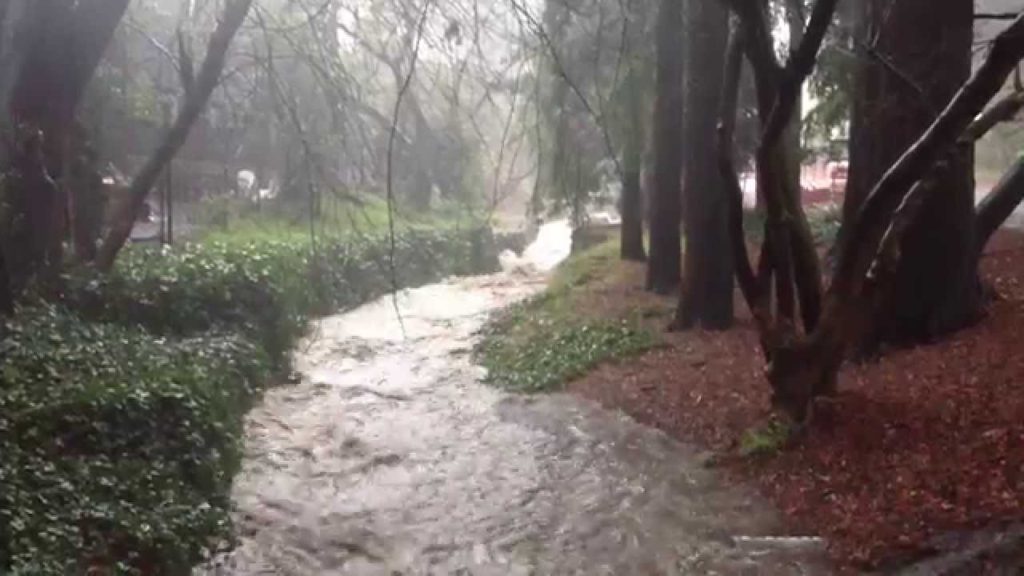
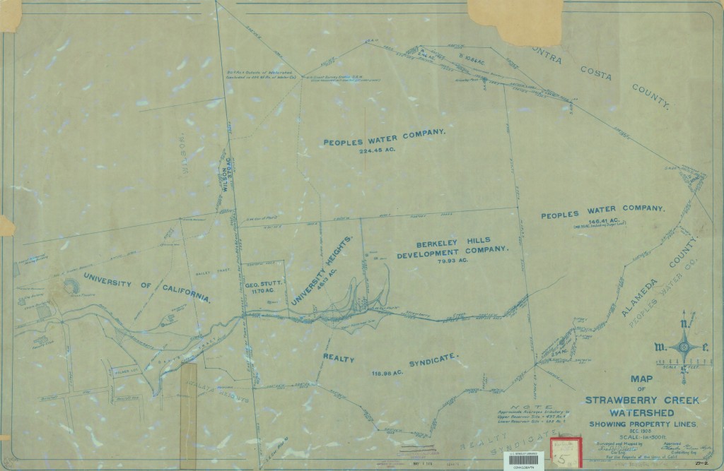
The 10,000+ Huchiun (Ohlone) people who live in the area harvest acorns and seeds and hunt game including elk, deer, pronghorn antelope, birds, fish and shellfish.
Strawberry Creek was the first surface water source for the University and parts of the city of Berkeley. A reservoir was constructed in the late 19th century in Strawberry Canyon, above the site of California Memorial Stadium. The reservoir was replaced in the early 20th century by the system of the East Bay Municipal Utility District whose source reservoir is located in the Sierra Nevada. Construction of the stadium removed a waterfall and culverted the creek in that area.
In the latter half of the 19th century, a road bridge and a railroad trestle both spanned Strawberry Creek in the downtown section at what is now the intersection of Shattuck Avenue and Allston Way. These were torn down and replaced by culverts in April–May 1893. In the process, a small grove of large and ancient oaks in the same locale was cut down.
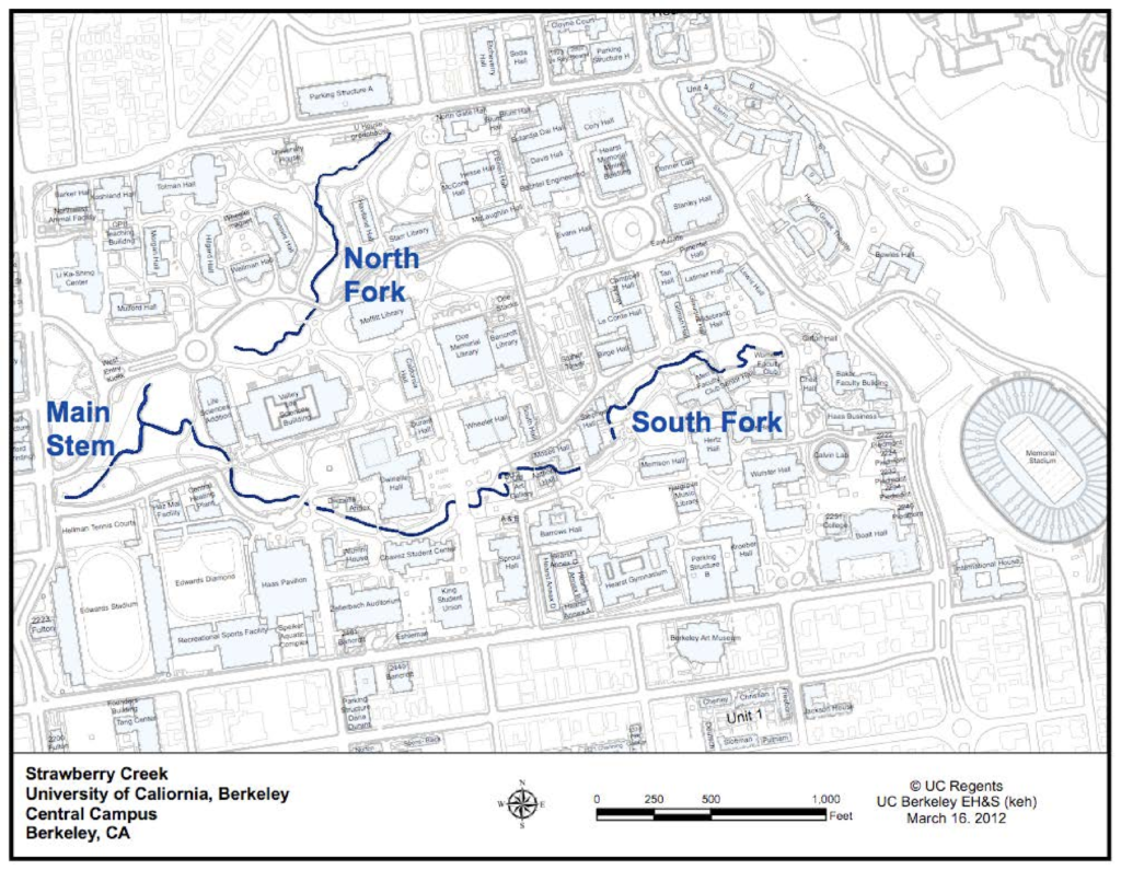
The creek has been culverted over the years in several other locations, notably in public-works projects during the Great Depression of the 1930s, but has remained open through most of the UC campus, except in the central glade where the two small middle forks were long ago filled in. The south fork of Strawberry Creek has some riparian coast redwood groves on the university campus and is also suitable habitat for the California slender salamander and arboreal salamander.
What You Will See
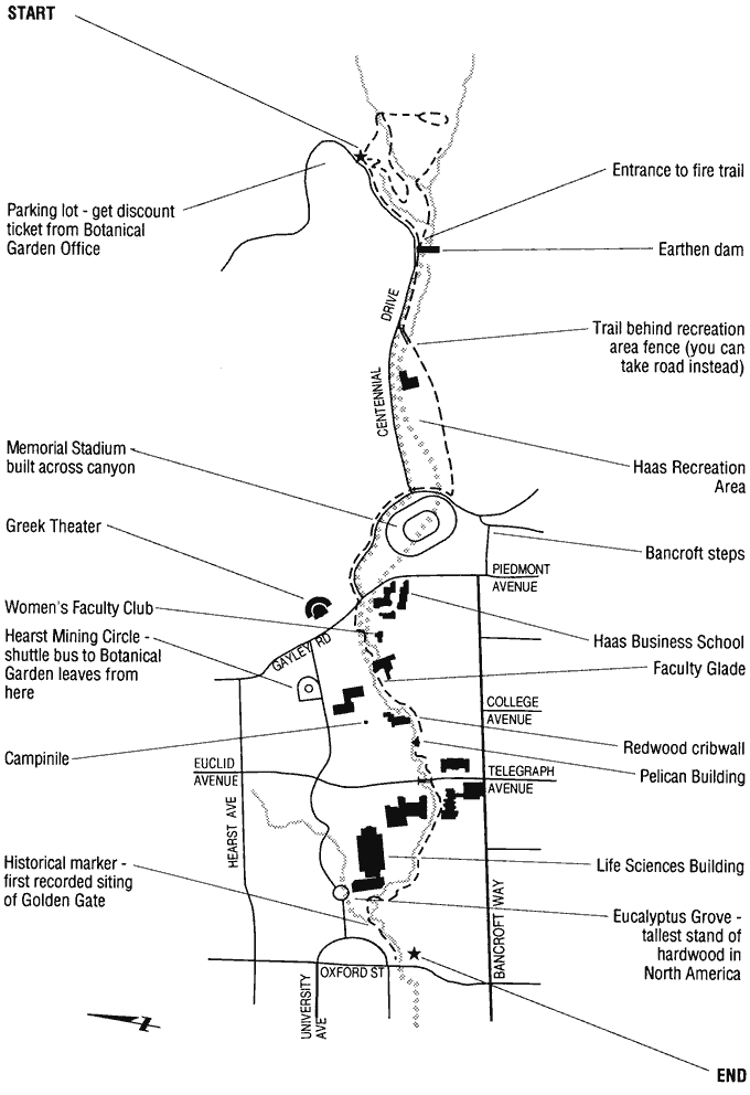
Publically accessible hiking, walking, and biking trails provide a wide range of recreational opportunities. UC Berkeley offers an interactive map of the recreational areas along the north fork and Strawberry Creek proper. The mouths of Strawberry and Schoolhouse creeks are located in Eastshore State Park, which is managed by the East Bay Regional Park District. The district’s website contains a variety of information on recreational activities in this area.
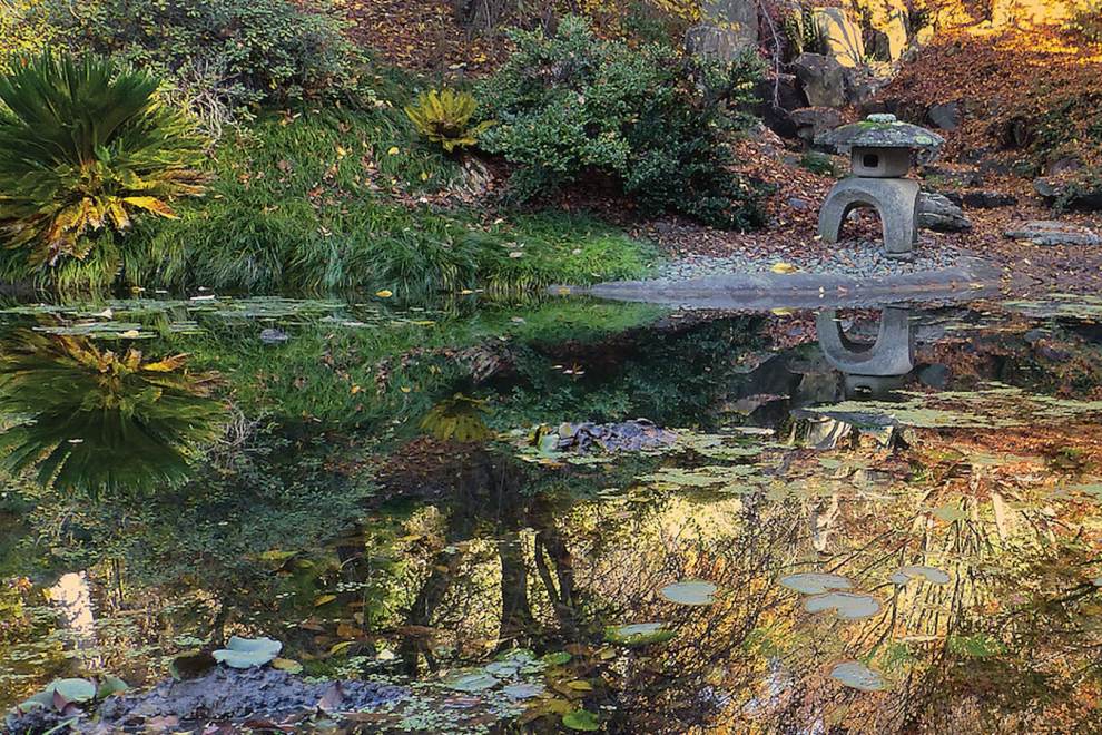
UC Berkeley Botanical Garden via David Lance Goines
UC Botanical Garden
The UC Botanical Garden is located in Strawberry Canyon above Memorial Stadium. Strawberry Creek runs through the heart of the 34-acre garden and is surrounded by an impressive collection of more than 13,000 different plants. The garden is open daily from 9 a.m. to 4:45 p.m. from fall to spring and 9 a.m. – 7 p.m. from Memorial Day to Labor Day.
Strawberry Creek Park
Strawberry Creek Park, located between Bancroft Way and Addison Street in southwest Berkeley, was the site of one of the first daylighting projects in the United States. The 1984 project uncovered a buried section of creek that now runs through the 3.7-acre park and is bordered by native California plants. The project is often cited as a prime example of successful daylighting and creek restoration efforts. The park’s recreational opportunities include basketball, tennis, volleyball, and picnicking. The north-south path through the park can be walked or bicycled all the way to Richmond via the old railroad grade (now mostly the Ohlone Greenway, along the Bay Area Rapid Transit line).
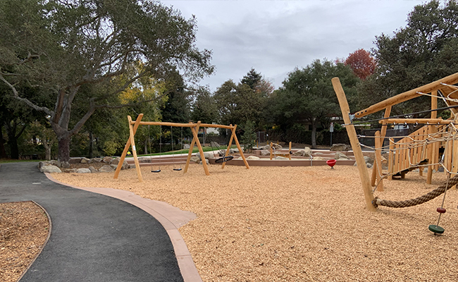
Strawberry Creek Park via cityofberkeley.info
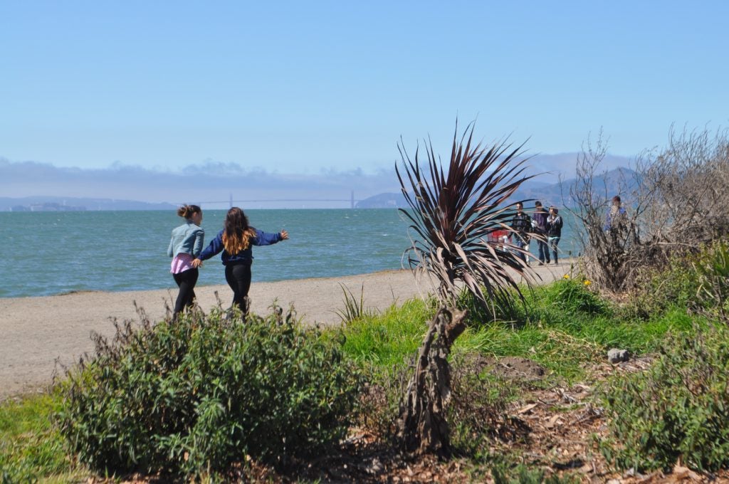
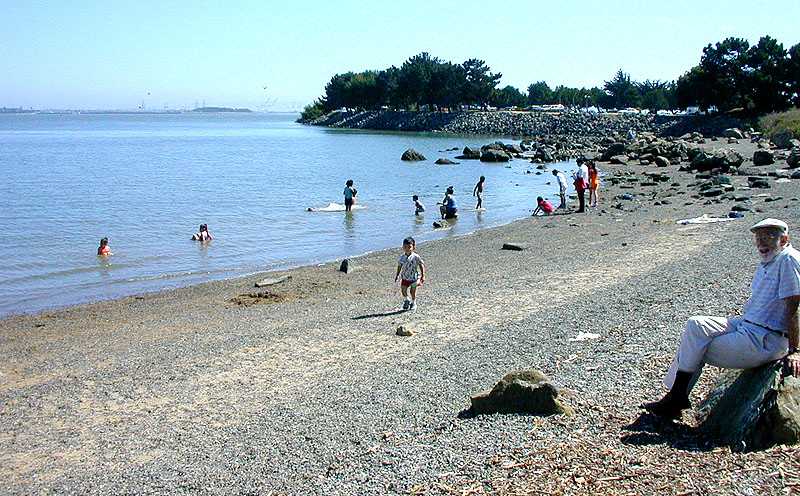
McLaughlin Eastshore State Park
McLaughlin Eastshore State Park extends 8.5 miles along the East Bay shoreline from the Bay Bridge to Richmond. The mouths of Strawberry and Schoolhouse creeks are both located in this park, which offers a network of pedestrian and bicycle trails. Strawberry Creek reaches the Bay via a large pipe on the south side of University Avenue, a short distance west of I-80. A new Bay Trail extension offers an excellent view of the mud flats at the creek mouth, which are often dense with migrant and wintering shorebirds between fall and spring. Schoolhouse Creek exits its pipe just north of the Virginia Street Extension, which is now a park trail. Tide flats here are another popular fall-to-spring birding area. Local trails connect these creek mouths to the restored Berkeley Meadow and Shorebird Park, Cesar Chavez Park, and Berkeley Marina. On the Bay Trail, walkers and bicyclists can follow the shoreline from Emeryville all the way to the Richmond Marina and Rosie the Riveter National Historic Park.
Fun Facts!
The Huchiun Ohlone tribe originally inhabited the area around Strawberry Creek
UC Berkeley’s first classes were held in Oakland until the campus was constructed around the creek
Robert Charbonneau, one of Berkeley’s graduates, proposed a management plan to UC Berkeley’s Office of Environment, Health and Safety in 1987 to save the creek
